LiDAR Survey of Dalreoch Field
LiDAR or Light Detection and Ranging is a surveying method that measures distance to a target by illuminating the target with laser light and measuring the reflected light with a sensor. Differences in laser return times and wavelengths can then be used to make digital 3-D representations of the target (Wikipedia). The Vale of Fortingall was included in LiDAR surveys as part of a flood risk mapping programme. The images below were produced from LiDAR files in the Scottish Remote Sensing Portal and show the topography of and features in the Dalreoch field.
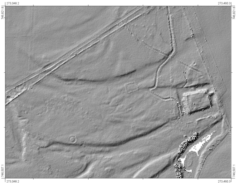
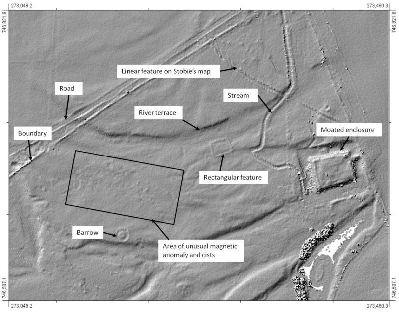
The LiDAR image corresponds well with the main features seen in the aerial photograph and magnetic anomaly survey and highlights other aspects of the field. The unusual magnetic anomaly in the “cist” area shows up as a band of small features in the LiDAR image. The extensive linear feature shown on Stobie’s map shows up in Dalreoch but is evidently ploughed out in the field to the east.