Previous Archaeological Exploration
One of the earliest recorded archaeological excavations was of the barrow beside a fallen cup-marked stone in the field then described as “Dalreoch, Fortingall” in 1884 (1).
More recently, archaeological excavations were carried out on the stone circles east of Fortingall in 1970 (2). A watching brief during work on sewer pipes in the field immediately south of Fortingall in 2007 found evidence of stone wall footings (3).
In 1986 cropmarks in aerial photographs suggested the presence of a pit-defined enclosure and a large rectangular enclosure south and east of Fortingall. Two Scheduled Monuments were designated SM8644 and SM8123 respectively in 1999.
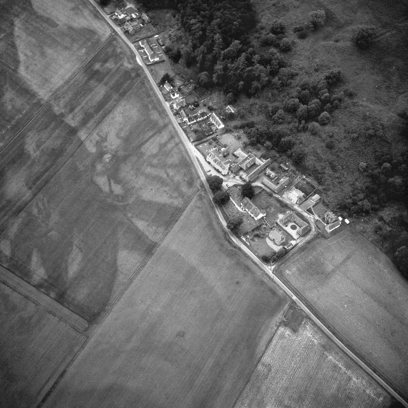
RCAHMS aerial photograph of the fields around Fortingall showing evidence of ditches in the crop marks (http://canmore.org.uk/collection/449876)
Scheduled Monument Geophysical Surveys 1999 to 2010
With the evidence from the aerial photographs, interest in better understanding the significance of the landscape features grew. Geophysical surveys were carried out in fields south of the village in 1999 by Jennifer Laing associated with SM8123 and in 2007 by Jon Tanner (4, 5) associated with SM8644.
No copy of Laing’s 1999 earth resistance survey has been found but but Tanner noted that it found three of the enclosure ditches (5).
The 2007 geophysical survey by Jon Tanner used earth resistance, fluxgate radiometer and magnetic susceptibilty methods on the pit-defined enclosure of SM8644. He concluded that it is similar to the unroofed post-hole built Neolithic timber halls found at Littleour and Carsie Mains in Perthshire (5).
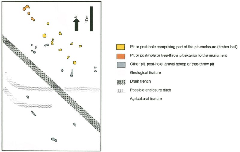
Interpretation Plot of the Magnetometer Survey of SM8644 adapted from Jon Tanner’s report of 2007 (5)
In 2010 Dr. O’Grady was granted permission for geophysical surveys on the rectangular enclosure of Scheduled Monument SM8123 in fields south and east of the village (6, 7).
Dr O’Grady considered that magnetometer survey shows the presence of ditches and earthworks that reflect the features in the aerial photographs, as well as pits that may represent occupational or industrial activity. Some features were thought to perhaps pre-date the ditched enclosure.
The 2010 survey in particular formed the basis for the granting of an excavation licence by Historic Environment Scotland for Scheduled Monument SM8123.
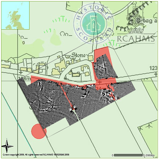
RCAHMS image of the Dr O’Grady’s SM8123 magnetometry survey, superimposed on the areas defined for the two Scheduled Monuments
Scheduled Monument SM8123 Excavation in 2011
A limited excavation in the Glebe field east of the Manse led by Dr. O’Grady in 2011 (8, 9) confirmed the presence of a substantial wall and ditch in the line of the crop-mark and as suggested by the geophysics survey. Carbon-dating suggested that the site had been occupied from the 7th-10th centuries CE.
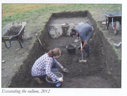
A trench through the “vallum” in the field to the south of the Fortingall Hotel uncovered an entrance and a roadway. A “traffic light” bead in a style recognised as Anglo-Saxon was found on the roadway. The indications are that the site may date back to the 6th century CE .
The excavator interpreted the aerial photographs, magnetometer survey and excavation results as consistent with three substantial ditched enclosures, roadways and pits of an Early Christan elite settlement from early Medieval Scotland. The boundary features or “vallum” resemble the earthwork or stockade which surrounded Iona’s Early Christian monastery.
The excavator, Dr O’Grady, planned to fully publish the work in 2019 at TAFAC but did not. Later his untimely death intervened. The unpublished excavation reports are with the Historic Environment Scotland Archives. The artefacts found were to be declared to the Treasure Trove Office. Historic Environment Scotland are aware of the issues.
One objective of the 2011 excavations was to determine whether the site is at risk of degradation as a result of modern farming practices. The excavator noted in his conclusions (9) that .. there is ongoing damage to in-situ archaeology immediately below the plough soil in the south-west field and that the evidence of plough damage indicates the site is under threat from modern agricultural activity.
Peter Heyes
References
- Stewart,C. (1884). Notice of sepulchral mounds and cup-marked stones, near Fortingall, in Glenlyon, Perthshire, Proc. Soc. Antiq. Scot, vol. 18, 1883-4. Page(s): 376-7
- https://canmore.org.uk/site/24985/fortingall-church
- Hindmarch, E., (2007). Fortingall Sewer. AOC Archaeology Ltd. accessed (May 2019) via https://archaeologydataservice.ac.uk/library/browse/issue.xhtml?recordId=1101264&recordType=GreyLitSeries
- Tanner, J. (2007). Fortingall: Geophysical Survey. Discovery Excav Scot, New Series, vol. 8, 2007. Cathedral Communications Limited, Wiltshire, England. Page(s): 158
- Tanner, J., (2007) A Geophysical Survey of the Pit Enclosure or Timber Hall at Fortingall, Perth and Kinross. Unpublished report.
- O’Grady, O.J.T. (2010). Culdee Monasteries: Geophysical Survey, Discovery Excav Scot, New Series, vol. 11, 2010. Cathedral Communications Limited, Wiltshire, England. Page(s): 143
- O’Grady, O.J.T., (2010), Fortingall Monastry, Fortingall, Perth and Kinross: Report on Geophysical Survey 2010. Unpublished report: HES Archives.
- O’Grady, O.J.T. (2011) Fortingall: Culdee Archaeology Project: Excavation and geophysical survey. Discovery Excav Scot, New Series, vol. 12, 2011. Cathedral Communications Limited, Wiltshire, England. Page(s): 151
- O’Grady, O.J.T., (2011), Geophysical Survey and Trial Excavation 2011: Data Structure Report. Unpublished report: HES Archives.