Background
The cultural heritage around Fortingall has attracted attention since at least the eighteenth century. In 1732 the noted antiquarian John Horsley (1) mentions ‘Fortingal’ camp in discussing possible sites of a battle between Romans and Caledonians in the 80’s AD. General Roy featured a ‘Roman Camp’ on his survey map of 1747-55, as did James Stobie in his map of 1783. Scobie’s map also shows a rectangular enclosure, a standing stone and a linear feature south west of Fortingall. The earliest OS map (1862) shows the ‘Roman Camp’, a rectangular ‘Praetorium’ and further to the east of Fortingall, standing stones.
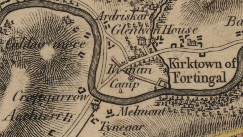
Fortingall in James Stobie’s 1783 Map (National Library of Scotland)
- Horsley, J. (1732) Britannia romana: The Roman antiquities of Britain. J. Osborn and T. Longman, London, p.44. accessed June 2019 https://archive.org/details/britanniaromanao00hors/page/44